The Nicaragua coastal highway is creating major ripples in the Popoyo area, changing the trajectory of real estate and life on the Emerald Coast. We are about to witness a major before-and-after thanks to the revolutionary highway cutting travel time and making this surf paradise more easily accessible.
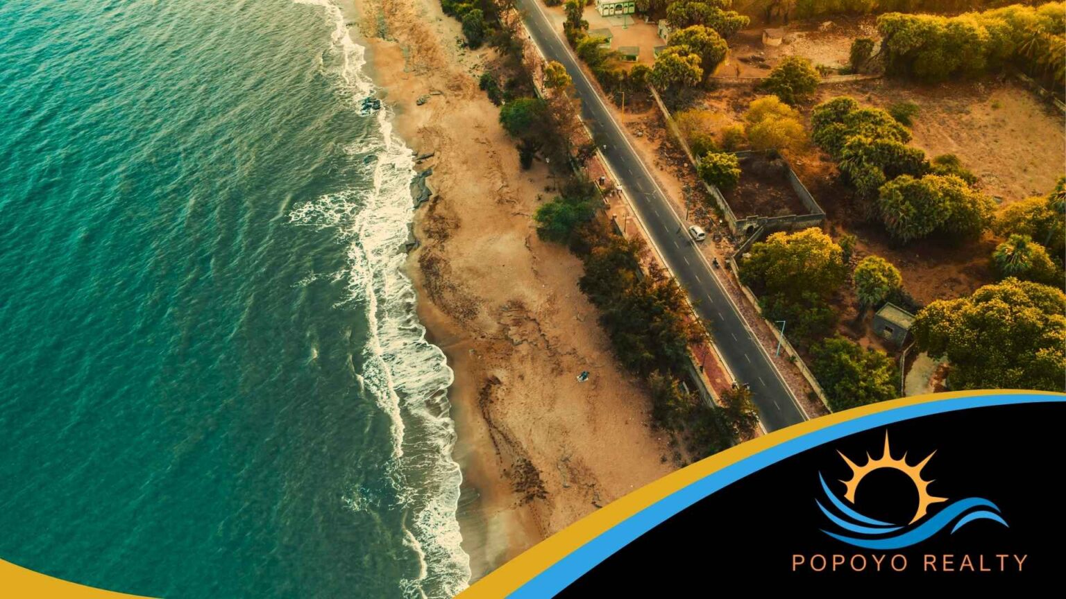
Before the coastal highway, much more effort was required to reach Popoyo. Rough roads and rainy season mud made the journey from Managua brutal. Only the truly committed made the trip. Now, a paved smooth highway runs 355 kilometers along the Pacific shore. Travel times have dropped dramatically. This stretch of coast has opened to an entirely new level of access. The Nicaragua coastal highway, officially the Carretera Costanera, is not a future promise. Key sections are already operational, and the changes coming to Popoyo and the surrounding Tola coastline are well underway.
What the Nicaragua Coastal Highway Actually Is
The Carretera Costanera ranks among the most significant infrastructure investments in Central America in recent decades. With a total budget of $400 million, funded primarily through a 15-year loan from the Central American Bank for Economic Integration and supported by the Nicaraguan government, this project is built to last. China has also committed funding for a second phase as part of a recently signed trade agreement. In total, the highway spans the full length of Nicaragua’s Pacific coast, linking the northern port of Corinto all the way south to San Juan del Sur, passing directly through the Tola district and the Popoyo corridor.
Once complete, the route will connect 64 beaches along the Pacific coast, linking travelers seamlessly between communities, nature reserves, surf breaks, and the tourism hubs that have been developing along this coastline for years. The first operational section, 30 kilometers connecting El Naranjo to Playa El Remanso, opened in late 2025. As of April 2026, the full first phase of 119 kilometers is in its final stages with completion expected in May 2026. Construction crews are pushing through the remaining terrain on multiple fronts simultaneously. The finish line is weeks away.
How the Highway Is Cutting Travel Times to Popoyo
This is where the change becomes tangible. The Nicaragua coastal highway has already slashed travel times across the entire southern Pacific corridor. One of the most striking examples is the drive between Popoyo and Playa Maderas near San Juan del Sur. That trip used to take at least an hour and a half on unpaved roads. Today, drivers cover that same distance in 45 minutes or less on completed sections of the highway. Two destinations that once felt like separate worlds now feel like part of the same coastline.
Travel from Managua to Popoyo has also dropped by approximately 40 percent. Previously, the route combined paved highway with unpaved dirt roads that became impassable during rainy season. Getting here demanded real commitment. Casual visitors stayed away, and the area was only realistic for those with a four-wheel drive and patience to match. Popoyo now sits just a two-hour drive from Managua on reliable paved surface. Rainy season is no longer a barrier. Drivers planning this trip today need nothing more than a tank of gas.
Why Accessibility Is the Real Game Changer
Faster travel times are the headline. However, the deeper impact of the Nicaragua coastal highway is what improved accessibility does to a place over time. When a destination becomes easier to reach, everything changes. More tourists can realistically visit. Renters who previously ruled out the area start booking. Buyers who could never picture the drive now can. The pool of people for whom Popoyo becomes a viable option expands significantly, and that expansion drives compounding effects on the local economy and the rental market.
What the Highway Means for Expat Families
Families considering a permanent move will find one of the most meaningful shifts in what the highway does for schooling options. San Juan del Sur has long offered more established choices for expat families, including an accredited, international school that draws people relocating from North America and Europe. Previously, living in Popoyo meant accepting those options were too far away to be practical. The highway changes that calculation entirely.
Popoyo to San Juan del Sur now takes 45 minutes or less, which means families can root themselves in Popoyo and still tap into San Juan’s institutional infrastructure for schooling, healthcare, and community. World-class surf outside the front door and viable family infrastructure within easy reach – that combination simply did not exist here before. Buyers who previously felt forced to choose between the two now have a genuine third option.
The Guanacaste Comparison
The clearest regional parallel is Costa Rica’s Guanacaste peninsula, located directly across the Nicaraguan border where this highway begins. Before paved coastal access arrived, Guanacaste was an overlooked stretch of Pacific coastline that most travelers could not reach conveniently. The infrastructure changed everything. Guanacaste became one of the most sought-after real estate markets in the Americas. Nicaragua is not Guanacaste in 1995. The underlying dynamic, however, runs exactly the same. Infrastructure opens a place. An opened place attracts attention. Attention drives demand. Demand moves prices.
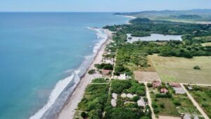
Beyond Popoyo, the full corridor benefits from this shift. Playa Santana, Rancho Santana, Hacienda Iguana, and the broader Tola coastline all gain from the same infrastructure investment. The highway is knitting together a unified coastal destination where isolated pockets of development previously sat separated by difficult terrain. That unification raises the profile of the entire region.
What This Means for Popoyo Property Values
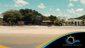
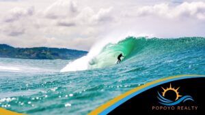
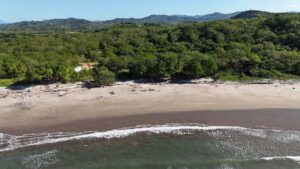
Popoyo sits directly in the path of everything this highway is unlocking. The area has always carried the fundamentals. Popoyo’s main break ranks among the top right-hand point breaks in Central America, drawing a consistent global surf audience that generates rental income and keeps the area on the international map year-round. An established expatriate community has built restaurants, surf camps, and rental properties that give the area genuine depth beyond the beach itself.
Easy access is what Popoyo has lacked until now. That gap has kept it in the category of places people love but struggle to get to. The Nicaragua coastal highway is closing that gap, and the property market is starting to reflect it. Regional analysts describe the expected trajectory as steady and compounding rather than an overnight spike. This is infrastructure-driven appreciation of the kind that builds genuine long-term value, not a speculative bubble.
Comparable surf destinations in Costa Rica or Mexico carry price tags that reflect years of established access. Popoyo still prices like an early-access market. The road is new. The full repricing that follows major infrastructure completion takes time to move through a market. That gap between what the road has already changed and what land prices have not yet caught up to is exactly the window buyers are watching right now. Nicaragua’s legal framework lets foreign buyers hold fee-simple title directly, giving international buyers the same ownership protections as local citizens.
Take the Next Step
Popoyo Realty specializes in properties along the Nicaragua coastal highway corridor, from beachfront communities like Popoyo and Playa Popoyo to gated communities like Rancho Santana, and Hacienda Iguana. If you want to understand what the highway means for specific properties and current pricing along the Tola coast, we can walk you through everything.
Contact us directly at popoyorealty.com to get started.
Frequently Asked Questions
What Is the Nicaragua Coastal Highway?
The Nicaragua coastal highway, officially called the Carretera Costanera, is a 355-kilometer paved highway running along Nicaragua’s Pacific coast from the northern port of Corinto to San Juan del Sur. With a total budget of $400 million, it is one of the most significant infrastructure investments in Central America in recent decades.
Is the Nicaragua Coastal Highway Finished?
Key sections are already operational. The first section opened in late 2025, and as of April 2026, the full first phase of 119 kilometers is in its final stages with completion expected in May 2026.
How Does the Highway Affect Travel Time to Popoyo?
Travel from Managua to Popoyo has dropped by approximately 40 percent. The drive now takes around two hours on reliable paved surface, making Popoyo accessible year-round, including during rainy season when dirt roads previously made the route impassable.
What Does the Highway Mean for Popoyo Real Estate?
Improved access expands the pool of tourists, renters, and buyers who can realistically consider Popoyo. Regional analysts expect steady, compounding appreciation driven by infrastructure, similar to what Guanacaste, Costa Rica experienced after paved coastal access arrived.
Can Foreigners Buy Property in Nicaragua?
Yes. Nicaragua’s legal framework allows foreign buyers to hold fee-simple title directly, giving international buyers the same ownership protections as local citizens.
Which Other Areas Along the Tola Coast Benefit From the Highway?
Beyond Popoyo, the highway connects communities including Playa Santana, Rancho Santana, Hacienda Iguana, and the broader Tola coastline, knitting together a unified coastal destination where isolated pockets of development previously sat separated by difficult terrain.
How Does Popoyo Compare to Other Surf Real Estate Markets?
Comparable surf destinations in Costa Rica and Mexico carry price tags that reflect years of established access. Popoyo still prices like an early-access market, creating a window between what the road has already changed and what land prices have not yet caught up to.